


Drone LiDAR Frequently Asked Questions
- Rekon Solutions Inc
- Dec 17, 2019
- 3 min read

How accurate is Rekon's Drone LiDAR?
The accuracy is customizable to your project needs and will dictate how we plan the flight profiles. The achievable range of vertical accuracy is between 3cm to 12cm RMSE (root mean square error) at a 95% confidence level.

How much ground can Rekon's Drone LiDAR cover per day?
In the most ideal conditions using drone LiDAR we can cover up to 387 Hectares (Ha) per day. In more typical cases the average coverage is more near to 100 Ha per day. Access and lines of sight are major deciding factors.

Can you fly near airports?
Yes, our Chief pilot holds an advanced RPAS (remoteley piloted aircraft systems) pilot certificate and can coordinated with ATC (air traffic control) to allow for operations that can even be directly adjacent to an airport.

What is the typical point density in a LiDAR scan?
300 points per square meter is typical, we can get as low as 100 and as high as 1000 or more depending on the requirements of the project. We can adjust these numbers by speeding up or slowing down flight speed and or adjusting the number of returns captured by the scanner.

What kind of files or deliverables will be provided after a LiDAR scan?
Our standard deliverables are, a DEM(digital elevation model) ,an AutoCAD contour lines file of the ground based on the classified point cloud, a filtered point cloud file with ground only points, and the raw point cloud file. We are also able to produce many other deliverables upon request.

What is the typical cost per day for the Drone LiDAR service?
There are many factors that go into deciding how much a project will cost. Factors like, site accessibility, overall topography and it's affect on lines of sight, type and density of vegetation ,time of year and project quality level requirements to name a few. For basic day rates on Drone LiDAR and Rekon's other services visit our Service Cost page.

How do you do Quality Assurance and validate the LiDAR scan?
To validate the scan a terrestrial GPS survey is performed. The ground proofing shots will span over the scanned area evenly and be no less the 10 points. In large areas of 50 hectares and more we use 1 shot per 5 hectares as a rule of thumb. These shots are used to quantify the level of quality.

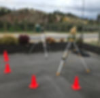
Do you set ground control points (GCPs)?
Yes, we use special targets that are highly reflective to our laser. First we position them in the scan area and then survey their position using a terrestrial GPS system. In Post, due to their highly reflective nature we can identify their position in the LiDAR scan. Using those points we can evaluate how well the scan is calibrated and also how accurately the scan aligns with the measured location of the targets.
How do you establish your site datum like geodetic heights and coordinates?
We do this one of three ways; The first method is applied if the project site is within the Can-Net subscription area, If it is, we establish a control pin using the networks corrections. In post the position is checked using the Precise Point Positioning service from the Natural Resources Canada web application. The second method is we establish a control pin location by logging GNSS data for a period long enough to develop the required absolute accuracy. That log file will then be processed through the Precise Point Positioning service and the resulting position will then be used for the project. Last, if the site already has control pins we will observe their position at the same time we do our ground proofing and correct our heights and coordinates to align with the site's.
Do you have question we have not addressed in this FAQ? Please feel free to Contact Us. We are more than happy to answer questions about Drone LiDAR, Truck LiDAR and Drone Photogrammetry.